 Cette semaine j'avais envie de découvrir la Gasteretal, vallée sauvage perdue entre l'Oberland bernois et le Valais. Une longue randonnée (temps standard 8.30 h) donc entre Kandersteg et la Lötschental, en passant par le Lötschpass à 2700 mètres.
  This week I wanted to discover the Gasteretal, wild valley lost between Berner Oberland and Valais. A quite long hike (standard time 8.30 h) from Kandersteg to the Lötschental, via the Lötschpass (2700 m).
___________________________
Départ de la gare de Kandersteg, direction le Lötschpass puis Ferden. Une fois là, un bus postal descend chaque heure à Goppenstein, correspondance pour le train du Lötschberg pour revenir à Kandersteg (trajet total environ 35 min).
Start at the railway station in Kandersteg and head to the Lötschpass then to Ferden. Once there a postbus goes down every hour to Goppenstein, connecting to Kandersteg via the Lötschberg tunnel (takes 35 min overall).

Ça commence par une belle matinée de fin septembre à Kandersteg. Belle mais froide, environ 2°C à 8h du mat. Je me dirige vers le fond de la Kandertal. Une fois là, je bifurque à gauche vers la Gasteretal. A droite, c'est la montée vers Sunnbüel et le Gemmipass.
It starts with a beautiful morning end of September in Kandersteg. Beautiful but cold, around 2°C at 8am. I'm heading to the end of the Kandertal then will turn left to enter in the Gasteretal. To the right, it's the climb to Sunnbüel and the Gemmipass.
Dernier coup d’œil sur la Kandertal.
Last glimpse on Kandertal.
J'adore ce moment où l'on sort de la pénombre et que la beauté du paysage s'apprête à nous scotcher.
I love that moment when both the sun and the view are about to blow your mind.
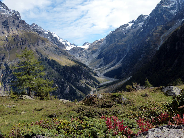
Ça y est, j'ai mis les pieds dans cette belle Gasteretal, coincée entre le Doldenhorn à gauche et le Balmhorn à droite. Belle atmosphère non ?
Alright, I'm in the Gasteretal, between Doldenhorn to the left and Balmhorn to the right. Very nice atmosphere isn't it ?
J'ai droit à 7-8 km de plat, entre pâturages et forêt. Autant vous dire que je n'ai pas croisé grand monde...
I've got 7-8 km of flat trail, between pastures and forest. Needless to say, I didn't see much people...
Des nuages viennent troubler le moment, heureusement il ne resteront pas longtemps.
Clouds are trying to ruin the party but fortunately they won't stay too long.
La montée au Lötschpass débute. 1500 mètres au total depuis Kandersteg.
The climb to the Lötschpass starts. 1500 m up overall from Kandersteg.
Naturellement, la vue s'ouvre au fur et à mesure que je monte. On voit la fin de la Gasteretal et le début du glacier du Kanderfirn. De l'autre coté, c'est la haute vallée de Lauterbrunnen, visitée cet été (article).
Obviously, the view gets wider as you go up. We can see now the end of the Gasteretal and the Kanderfirn glacier. On the other side is the upper Lauterbrunnen valley, which I visited earlier this summer (article).
Petit coin de paradis, justement appelé Schönbüel. La montée continue tout droit en longeant les sapins sur leur gauche, pour passer l'ancienne moraine du glacier Lötschegletscher.
Very nice place, righlty called Schönbüel. The climb goes straight up, along the pine trees, to pass over the old moraine of the Lötschegletscher glacier.
Dernier coup d’œil sur la Gasteretal et le gros Doldenhorn. Le Mutthorn siège au milieu du glacier. Derrière sur sa droite, la belle Jungfrau. A gauche du Mutthorn, on voit le Gspaltenhorn et les Blümlisalp.
Last look over the Gasteretal and the big Doldenhorn. The Mutthorn is sitting in the middle of the glacier. Behind it and to its right is the pretty Jungfrau. To its left are the Gspaltenhorn and Blümlisalp.
Je laisse tout ça derrière et j'avance vers le glacier qu'on devine déjà. A fond, le Ferdenrothorn.
Moving on towards the glacier. On the background, the Ferdenrothorn.
Le chemin passe sur le glacier puis saute la barrière rocheuse à gauche, pour arriver au col. Parfois c'est pas évident de trouver la trace.
The trail crosses the glacier, goes over the rocks to the left hand side and then arrives to the pass. Sometimes following that trail wasn't easy.
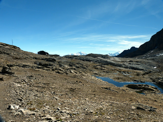
Plus que quelques mètres... De montée je veux dire ! Les alpes valaisannes pointent le bout de leur nez. Je commence à accélérer :-).
Just a few meters left. Well, uphill I mean ! The valaisan Alps are showing up. Walking faster now :-).
La vue est assez sympa là haut.
Nice view over there.
On commence à voir la crête qui sépare la Lötschental du reste du Valais, avec le superbe Bietschhorn en vedette.
Here's the ridge between the Lötschental and the rest of the Valais, with the almighty Bietschhorn.
C'est assez photogénique ce Lötschpass...
Quite a photogenic place this Lötschpass...
Moutons de compét !
Coolest goat ever.
A mi-chemin de la descente, l'alpage de Kummenalp.
Half way downhill, the Kummenalp pasture.
Après une descente de 1300 mètres, j'arrive dans la belle Lötschental. Au fond, le petit col enneigé, le Lötschenlücke, sépare cette vallée du Grosser Aletschfirn, branche du gigantesque glacier d'Aletsch.
After 1300 m of downhill, I made it to the beautiful Lötschental. On the background the tiny snowy pass, the Lötschenlücke, separates the valley from the Grosser Aletschfirn, branch of the huge Aletsch glacier.
 Pas été déçu ! Décors spectaculaires, variés et sauvages. On est à l'écart de tout. C'est long mais c'est bon.
 I wasn't disapointed ! Spectacular, wild and diverse landscapes. Pretty isolated too. It's a long one but it's so worth it.


Aucun commentaire:
Enregistrer un commentaire