
 Début juillet, j'ai été finir une longue randonnée au Pilatus, commencée en 2013. J'étais parti du col du Glaubenberg et j'espèrais finir au Pilatus. Les nuages et la fatigue m'avaient fait descendre de la crête plus tôt que prévu. Cette fois je remonte sur la crête et je la termine !
 Early July, I finished a long hike up to Pilatus that I started in 2013. Back then I started from Glaubenberg pass and hoped to go up to Pilatus. Tiredness and clouds teamed up against that plan. Today I'm back on the ridge to finish this!
______________________________________
Depuis Alpnachstad, droit vers la Tripolihütte puis Mittaggüpfi, Tomlishorn et Pilatus. Descente en funiculaire.
From Alpnachstad, straight to Tripolihütte. Then Mittaggüpfi, Tomlishorn and Pilatus Kulm. Cogwheel train back down.

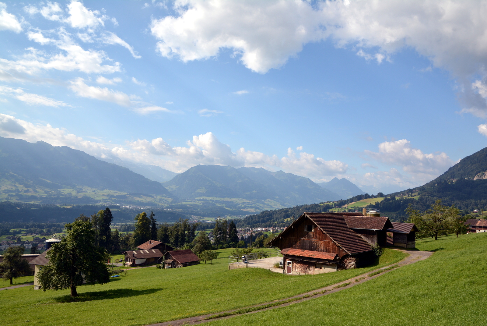
Départ d'Alpnachstat (430 m) au pied de la Pilatus Bahn.
Start from Alpnachstat (430 m) and Pilatus Bahn.

La vallée principale du canton d'Obwald. On devine l'entrée de la Melchtal. Tout au fond je crois voir Güpfi.
The main valley of canton Obwald. You can guess the entry to the Melchtal. On the background I think I see Güpfi.
Montée pas fatiguante sur les routes d'alpage (Lütoldsmatt).
Easy way up on a road between pastures (Lütoldsmatt).

Wängen (1570 m).

Tripolihütte (1763 m).

Je suis sur la crête. Derrière moi, les régions du Glaubenbergpass au loin et celle d'Entlebuch à droite en bas.
I'm on the ridge now. Behind me, Glaubenbergpass (ahead) and Entlebuch (right side, below) areas.

Devant, la montée vers le Mittaggüpfi (1917 m).
In front, the way up to Mittaggüpfi (1917 m).

Je descend du Mittaggüpfi, comme il y a 3 ans, les nuages gâchent un peu les photos. En bas c'est l'Eigenthal et en face en devrait voir le reste du Pilatus (Tomlishorn, Kulm).
Coming down the Mittaggüpfi and like 3 years ago the clouds are ruining the pictures. Down there that's Eigenthal and ahead you should see the rest of the Pilatus range (Tomlishorn, Kulm).

Mittaggüpfi loin derrière à présent.
Mittaggüpfi far behind me now.

Je laisse tomber le petit détour au Widderfed, l'un des sommets de la crête du Pilatus. Le sentier descend et passe en dessous. Il y a un passage légèrement technique équipé d'un câble.
I ignored the little detour to Widderfed, one of the summit of the range. The path goes around and below it. Slightly technical section, equipped with a cable.

Du vent et des nuages. En face le Tomlishorn (2128m) et une joli crête légèrement exposée pour y arriver.
Wind and clouds. Ahead that's Tomlishorn (2128 m) and a nice slightly exposed ridge to get to it.

En haut du Tomlishorn, le plus haut sommet de la crête. Pilatus Kulm à gauche et Matthorn à droite. Lac des Quatre-cantons en bas.
On top of Tomlishorn, the highest peak of the range. Pilatus Kulm to the left and Matthorn to the right side. Lake Lucerne down there.

A partir du Tomlishorn, c'est tourisme de masse jusqu'au Pilatus Kulm. Sentier goudronné et hyper sécurisé. Ça reste joli mais on n'est plus seul :-).
From Tomlishorn to Pilatus Kulm, it's mass tourism. Path is paved and made super safe. It's still pretty but you are not alone anymore :-).

Pilatus Kulm, gare d'arrivée du téléphérique et du funiculaire.
Pilatus Kulm, cable car and cogtrain station.

Et c'est parti pour une longue descente bien raide en funiculaire. En face c'est le Stanserhorn.
Here we go for a long steep downhill in the cogwheel train. Ahead that's Stanserhorn.

Je suis monté au Pilatus plusieurs fois, c'était la première de ce coté-ci. C'est joli par ici, belle crête fleurie et impressionnantes vues au loin.
I went up Pilatus a few times but from this side that was a first. It's pretty, beautiful and flowered ridge with stunning views.
N
Aucun commentaire:
Enregistrer un commentaire